Trail Walking La Chaudière - TRK000 - Photo
© OpenStreetMap contributors
Length
Length
10.2 km
Max alt
Max alt
1565 m
Uphill gradient
Uphill gradient
808 m
Km-Effort
Km-Effort  
21 km
Min alt
Min alt
1043 m
Downhill gradient
Downhill gradient
808 m
Boucle
Boucle
Yes
Creation date :
2018-12-28 17:17:49.501
Updated on :
2020-10-01 17:55:45.333

(2 Reviews)

Walking
Walking
3h30
Difficulty : Difficult

Scan this QR Code to open this trail in the SityTrail application

FREE GPS app for hiking

Logo SityTrail SityTrail

IGN / Geographical institutes

Download SityTrail from the App Store Download SityTrail from Google Play

Logo SityTrail SityTrail Plus

The world is yours!

Download SityTrail from the App Store Download SityTrail from Google Play Download SityTrail on Huawei AppGallery

About

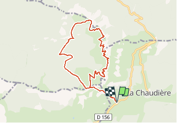
Trail Walking of 10.2 km to be discovered at Auvergne-Rhône-Alpes, Drôme, La Chaudière. This trail is proposed by Philindy26.

Description

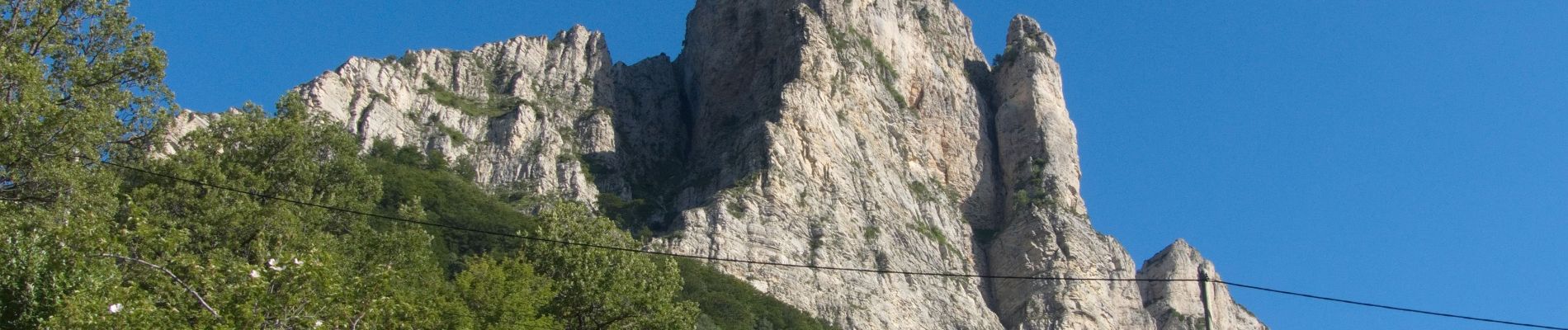
Départ du col de La Chaudière (1032m) au parking du Pas de Siara...
Géolocalisation (Google Maps) : https://goo.gl/maps/iVxDrN2vn2PcSPt59 .

Montée au Pas de Siara (1300 m),
Là prendre la direction du Veyou, point culminant des Trois Becs à 1589 m,
Continuer sur le Signal (1559 m) et Roche-Courbe ou la Pelle (1545 m).
Retour par les Rochers de la Laveuse (1376 m), le GR93, la Fontaine des Oiseaux (1190 m) et le virage du Pré de l’Âne (1210 m) pour revenir sur le Pas de Siara.
Retour au parking par le sentier de montée.

Elevation profile

Photos

Positioning

Country:
France
Region :
Auvergne-Rhône-Alpes
Department/Province :
Drôme
Municipality :
La Chaudière
Location:
Unknown
Start:(UTM)
674889 ; 4944183 (31T) N.

Comments

Please log in to post a review or rate the element


Close
My subscriptions